Thames Path Through Oxford
Oxford's full river traverse — from the gentle weirs of Iffley to the wild expanse of Port Meadow.
Most visitors never see the Thames in Oxford. They walk the High Street, peer into quads, and leave without realising that one of England's great rivers slides quietly through the city, flanked by towpaths, houseboats, and meadows that haven't changed much since the Victorians painted them. This walk follows the Thames (known locally as the Isis) from south to north, covering the full length of the river's passage through Oxford.
The path is flat and well-maintained throughout — no stiles, no mud in dry weather, and entirely accessible without special gear. It's the walk I'd recommend to anyone who's already done the colleges and wants to see the city that residents actually live in.
The route
Start: Iffley Lock (bus 3 from city centre, or 15 min walk south from Donnington Bridge Road)
Iffley Lock is one of the prettiest on the upper Thames. The lock-keeper's garden is immaculate, and the weir is genuinely dramatic after rain. Before setting off, walk 5 minutes south to Iffley village to see the Norman church of St Mary the Virgin — its Romanesque doorway is among the finest in England.
1. Iffley Lock to Donnington Bridge (0.5 miles)
Follow the towpath north along the east bank. The river is wide and slow here, with college boathouses lining the opposite bank during term time. On a spring morning, you'll see eights and fours training, coxes barking instructions across the water.
2. Donnington Bridge to Folly Bridge (1 mile)
Past Donnington Bridge the path enters Christ Church Meadow on your right — a vast flood-plain grazed by longhorn cattle. The confluence of the Thames and Cherwell is just to the east. Head Mans, an ornamental bridge, marks the college barges' former mooring point.
3. Folly Bridge (rest stop)
The ancient crossing point of Oxford. The Head of the River pub sits right on the bridge — good for a coffee or pint. This is where the Thames Path officially passes through the city centre, though you'd barely know it. Cross to the west bank here.
4. Folly Bridge to Osney (0.8 miles)
The path follows the west bank through Grandpont and into Osney, Oxford's island neighbourhood. The Victorian terraces of Osney sit on a genuine river island — one of the smallest inhabited islands in Europe, so the locals like to claim. Osney Lock is a quiet spot to pause.
5. Osney to Medley (1 mile)
Past Osney the river opens out. You'll pass under the railway bridge and along Fiddler's Island, with the rainbow-shaped Medley Footbridge crossing the main channel. The houseboats moored along here range from pristine narrowboats to gloriously eccentric floating homes. Medley Boat Station appears on your left — long-established, still renting punts and rowing boats.
6. Medley to Port Meadow (1.2 miles)
The path emerges onto Port Meadow, Oxford's ancient common land — by legend never ploughed for some 4,000 years, with the Freemen's right to graze it recorded in the Domesday Book of 1086. The meadow stretches north towards Wolvercote, and in winter it floods to become a temporary lake, attracting wading birds and wildfowl. The ruins of Godstow Abbey are visible at the far edge. Follow the towpath north to the Trout Inn at Godstow, or cut east across the meadow to Walton Well Road for the walk into Jericho.
End: Godstow Road / Port Meadow — the Trout Inn is the natural finish, or catch a bus from Wolvercote back to the city centre.
Practical notes
- Distance: 5.5 miles (9km) point-to-point
- Time: 2.5 hours at a brisk pace, 3.5 hours with stops
- Terrain: flat towpath throughout, some sections unpaved but firm; muddy after heavy rain between Osney and Medley
- Best time: early morning for birdlife and rowing crews; late afternoon in summer for the golden light across Port Meadow
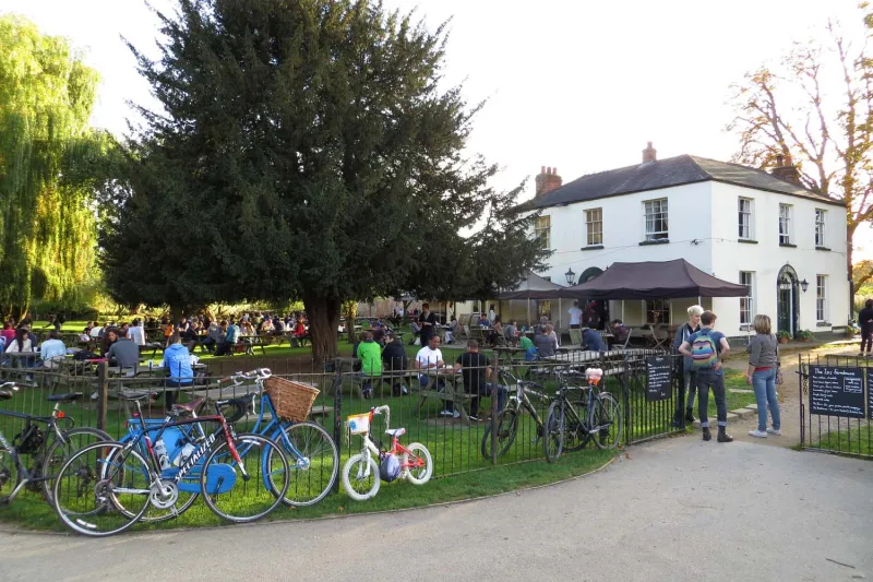
- Refreshments: Head of the River (Folly Bridge), The Punter (Osney), The Perch (Binsey — short detour), The Isis Farmhouse (a short detour south of Iffley Lock), The Trout Inn (Godstow)
- Getting back: bus 6 from Wolvercote to city centre, or walk east through Jericho (20 min)
Why this walk
Because it reframes Oxford entirely. The colleges are extraordinary, but they represent a fraction of the city's identity. The Thames Path shows you the working river — the locks, the boathouses, the houseboats, the meadows — and connects south Oxford to north Oxford in a way that nothing else does. It's the walk that makes you understand why Oxford exists where it does: at the meeting of two rivers, on ground that floods reliably enough to keep the meadows green and the developers away.